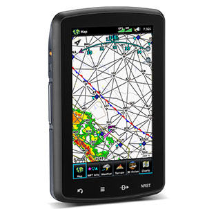
Garmin aera 796 Portable GPS
 |
|||
| Part Number: | 010-00967-10 |
||
Suggested Retail Price: |
$ 1,899.00 |
||
Our Price: |
$ 1,699.00 |
||
Premier Avionics is a
Garmin GTN750, GTN650 and G600/G500 Demo Dealer
- Overview
- Specifications
- In the Box
- Accessories
- aera 796 Video
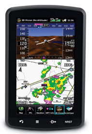
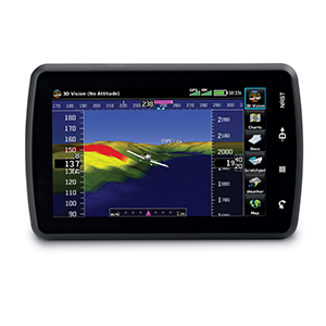
With its 3D Vision navigation technology, advanced electronic flight bag capabilities and XM capabilities, the touchscreen aera 796 ushers in the next era of aviation portables.
See in Virtual 3-D
Revolutionary new 3D Vision technology shows a virtual 3-D behind-the-aircraft perspective of surrounding terrain derived from GPS and the onboard terrain database — a feature previously only available in our panel-mount avionics. Simply slide your finger across the touchscreen to rotate the view and show land and water features, obstacles, runways and airport signposts in relative proximity to the aircraft. Using its forward-looking terrain avoidance capability, aera 796 predicts in advance where towers or obstacles may exist and shades the landscape with amber or red overlays to indicate those areas. 3D Vision and other flight data are presented smoothly and continuously thanks to the device’s internal GPS that provides position updates at a rate of 5 times per second (5 Hz).
Its bright 7" diagonal high-definition sunlight-readable display makes detailed mapping easy to see in any lighting conditions and works in both portrait and landscape mode. The physical design has been optimized to fit on the yoke or for use as a knee-mounted device. There are only 4 touch keys on the bezel representing "Back," "Menu," "Direct-to" and "Nearest" for quick navigation. Access all other functions through Intuitive onscreen icons with labels. This unique touchscreen interface even allows you to quickly pan across the map screen and pinch to zoom.
Go Paperless
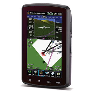
aera 796 fulfills the role of either a Class I or Class II electronic flight bag, greatly reducing the need to rely on paper charts in the cockpit. Initial georeferenced VFR sectional and IRF enroute charts come preloaded that show your aircraft’s position overlaid directly on the relevant chart. When in IFR map mode, the 796 can display victor airways, jet routes, minimum enroute altitudes and leg distance, much like what’s found on traditional enroute charts. Initial georeferenced Garmin FliteCharts provide approach charts and airport diagrams for the U.S., while pilots who prefer Jeppesen charts and diagrams can use optional Garmin ChartView service, which utilizes Jeppesen’s extensive library to provide global georeferenced charting capabilities. aera 796 also includes a robust document viewer, so you can easily pull up weights and balances, flight manuals, raster charts or a wide range of electronically formatted materials you download to the device. A “scratch pad” feature also allows you to quickly jot down clearances and other pertinent notes while in route, while a checklist viewer allows you to create customized and interactive electronic checklists.
Enhance Situational Awareness
aera 796’s built-in terrain and obstacle database not only shows contours in 3D Vision mode, but also allows for a top-down view of your entire route. To help you navigate around unfamiliar airports, SafeTaxi® provides detailed taxiway diagrams and position information for many U.S. or European airports, while a private airport and heliport database greatly expands your emergency “nearest” options. FBO, ground transportation, lodging and other facility information for most U.S. airports are also available through preloaded AOPA Airport Directory Data; international pilots may choose to opt for global
AC-U-KWIK airport directory data instead.
Access Weather and Radio
A GXM 40 smart antenna is included with aera 796, giving you access to high-resolution weather and audio entertainment right in the cockpit (XM subscription required). XM WX Satellite Weather includes next generation radar (NEXRAD), aviation routine weather reports (METARs), terminal aerodrome forecasts (TAFs), temporary flight restrictions (TFRs), lightning, winds aloft and more for the U.S. and Canada. In addition, the 796 can receive PIREPs, turbulence forecasts, icing forecasts and more. The weather data can be laid directly over the navigation and topographic map databases. Plus, with more than 170 channels of digital music, news and programming through your aircraft headset or cabin audio system, you’ll stay informed and entertained.
Expand Your Portable
Thanks to its 2 serial ports, aera 796 allows for simultaneous connectivity with other hardware. With an optional GTX 330 Mode S Transponder Interface, access Traffic Information Service (TIS) alerts, where available, right on the device while also sending frequencies to an SL30/40 radio or relaying position reports to other devices.
By adding optional City Navigator maps, both helicopter and fixed-wing pilots add street addresses as waypoints or direct-to destinations. The device includes an SD™ card slot for easy updates and expansions; easily keep track of the databases on your aera through flyGarmin.
![]()
![]()
![]()
![]()
What's in the Box:
- aera 796
- Yoke mount
- DC cigarette adapter 12/24 volt cradle
- Home A/C cradle dock
- GXM™ 40 XM smart antenna
- XM USB extension cable
- GA 25 remote antenna with suction cup mount
- USB cable
- Carrying case
- Touchscreen cleaning cloth
- Quick reference guide
- Complimentary single database update
- Pilot's Guide e-version (viewable on the document viewer)
Select an item below to expand the menu and show options.
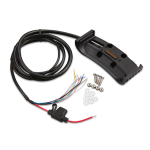 |
aera79X, Aviation Mount, bare wires | 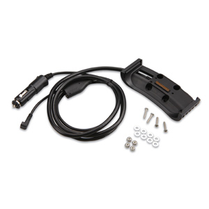 |
Aviation Mount with Power Cable |
| 010-11756-01 | 010-11756-00 | ||
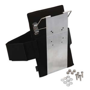 |
Lap Mount | 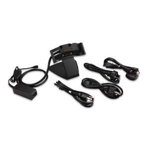 |
Home Dock with Cradle |
| 010-11756-05 | 010-11756-02 | ||
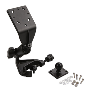 |
Yoke Mount | ||
| 010-11756-06 | |||
 |
GXM USB ext. cable (replacement) | 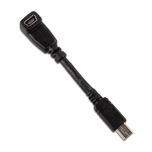 |
USB Adapter |
| 010-10617-02 | 010-11367-00 | ||
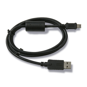 |
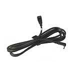
Mini USB Cable | 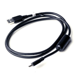 |
Mini USB Cable |
| 010-10723-15 | 010-10723-01 | ||
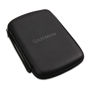 |
Carrying Case | ||
| 010-11756-03 | |||
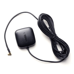 |
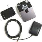
GA25MCX Remote Ant. (Low Profile) |  |
ADS-B Antenna |
| 010-10702-00 | 010-11825-00 | ||
 |
GA27C Auto Antenna (Low Profile) | 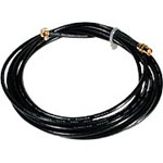 |
EXT. Cable for GA27 Antenna |
| 010-10052-05 | 010-10157-00 | ||
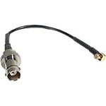 |
Adapter Cable (MCX to BNC) |
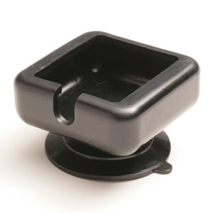 |
Suction Cup Mount for GA25 Ant. |
| 010-10121-00 | 010-10871-00 | ||
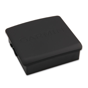 |
Battery Pack Replacement | ||
| 010-11756-04 | |||
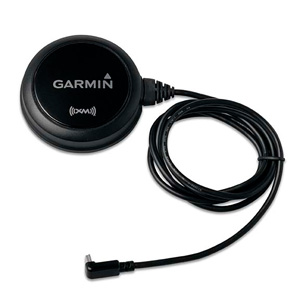 |
GXM40 Receiver | ||
| 010-00730-00 | |||
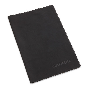 |
Cleaning Cloth | ||
| 010-11755-00 | |||
| $5.00 | |||